logo Vind Nå Kom igang Kontakt info Innstillinger

Namsos, Spillumsfjellet paragliding spot

NVNV

Trøndelag - Namsos - Spillum
(Data fra flightlog.org - statistikk siste flyture)

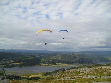
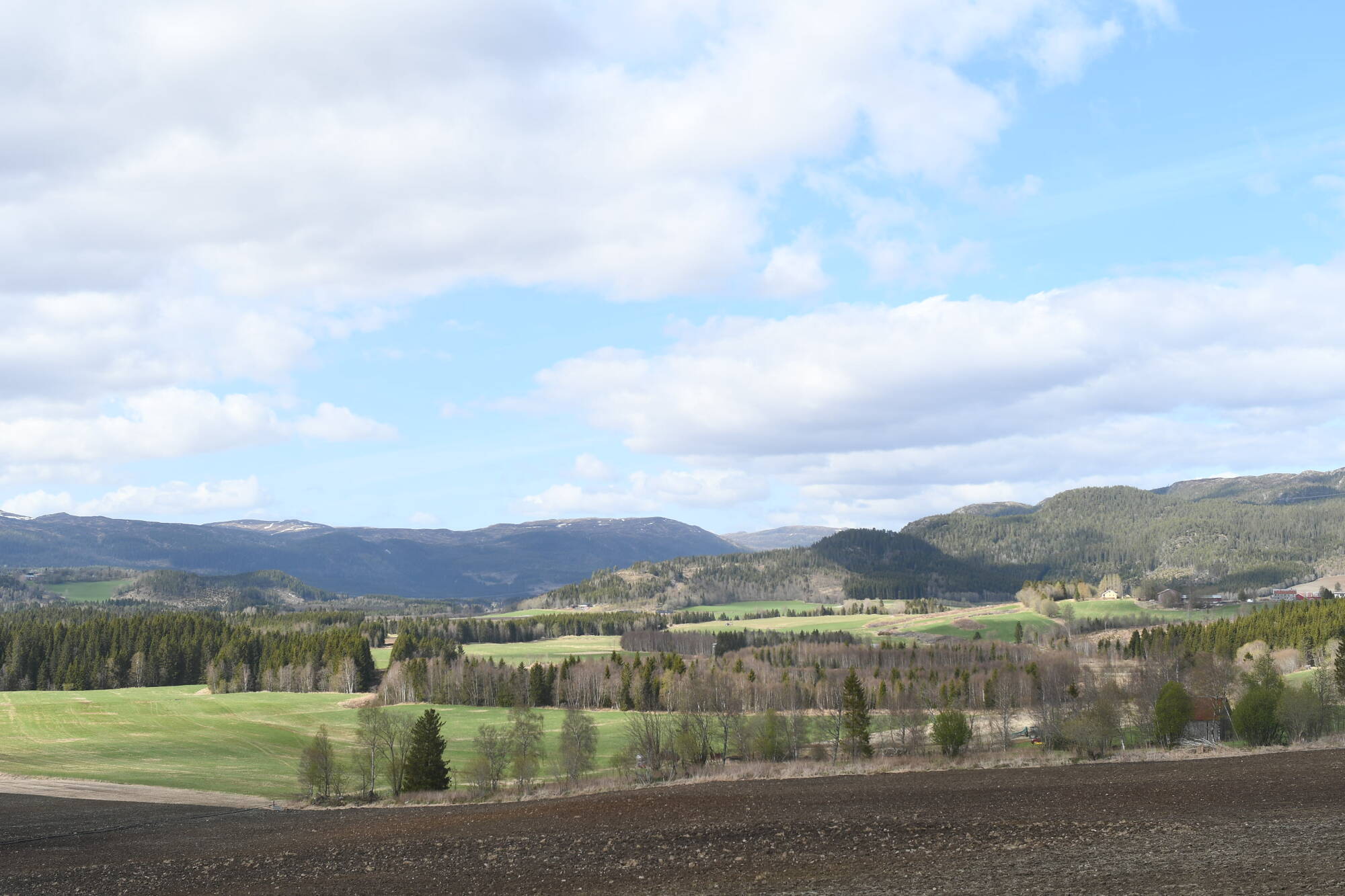
Like utenfor Namsos sentrum ligger Spillumsfjellet. Kjør over broen mot sør og du vil se fjellet rett foran deg. Det finnes en sti nord-vest (framsiden), og en bil vei (stengt med bom) på motsatt side.
Ring Wiik, tlf. 742 76298 for avtale om bilkjøring opp. 4WD!
HUSK Å RINGE FLYPLASSEN FØR FLYGING, TLF 742 75203

385 meters asl Høydeforskjell 382 meters

Kjenner du til denne spotten og har lyst å hjelpe Vindnå.no med oppdatert informasjon, sende inn dine endringsforslag her.

Bilde fra flightlog.org.

Kart

Værvarsel fra yr.no

 14:00  15:00  16:00  17:00  18:00  19:00  20:00  21:00  22:00  23:00  00:00  01:00  02:00  03:00  04:00  05:00  06:00  07:00  08:00 
yr.no
nedbør00000000000000000.11.10
m/s 5.65.75.85.95.84.23.43.73.84.24.85.76.77.26.97.37.176.6
V
(257)
V
(252)
SV
(242)
SV
(241)
SV
(245)
SV
(239)
SV
(218)
SV
(207)
SV
(203)
SV
(204)
SV
(208)
SV
(215)
SV
(218)
SV
(216)
SV
(219)
SV
(225)
SV
(221)
SV
(228)
V
(260)
C1212.212.111.510.28.97.46.45.85.75.75.8666.16.25.85.95.2

Live værdata NAMSOS LUFTHAVN 2.9 km unna.

 13:50  13:40  13:30  13:20  13:10  13:00  12:50  12:40  12:30  12:20  12:10  12:00  11:50  11:40  11:30  11:20  11:10  11:00  10:00  09:00  08:00  07:00  06:00  05:00  04:00 
m/s 5.64.85.35.86.86.45.96.66.37.57.67.66.26.66.26.36.16.16.77.16.25.75.56.65.7
SV
(238)
SV
(234)
V
(248)
V
(251)
V
(252)
V
(249)
SV
(245)
SV
(247)
SV
(243)
SV
(241)
SV
(237)
SV
(233)
SV
(225)
SV
(232)
SV
(237)
SV
(241)
SV
(243)
SV
(244)
SV
(244)
SV
(242)
SV
(246)
V
(249)
SV
(246)
SV
(240)
V
(252)

Live værdata Namsos 3.0 km unna.

 13:50  13:40  13:30  13:20  13:10  13:00  12:50  12:40  12:30  12:20  12:10  12:00  11:50  11:40  11:30  11:20  11:10  11:00  10:00  09:00  08:00  07:00  06:00  05:00  04:00 
m/s 5.55.55.35.54.26.16.55.75.66.27.26.87.46.965.35.75.75.96.366.53.53.84.8
max 6.66.97.17.75.77.78.48.37.28.198.410.69.48.78.27.89.27.98.37.78.35.25.86.5
V
(261)
V
(261)
V
(258)
V
(263)
V
(272)
V
(273)
V
(267)
V
(277)
V
(274)
V
(273)
V
(270)
V
(266)
V
(268)
V
(264)
V
(274)
V
(281)
V
(286)
V
(289)
V
(272)
V
(255)
V
(248)
V
(254)
V
(275)
V
(278)
SV
(244)

Live værdata Fv 17 Gryta 17.6 km unna.

 13:40  13:30  13:20  13:10  13:00  12:50  12:40  12:30  12:20  12:10  12:00  11:50  11:40  11:30  11:20  11:10  11:00  10:00  09:00  08:00  07:00  06:00  05:00  04:00 
m/s 1.92.72.62.52.43.12.82.12.33.13.22.83.63.63.53.43.32.72.432.32.12.31.9
max 45.86.65.45.99.96.64.25.98.89.39.38.87.68.89.77.56.166.55.75.15.54.5
V
(253)
V
(255)
SV
(243)
SV
(247)
V
(254)
V
(259)
V
(258)
V
(257)
SV
(246)
SV
(245)
V
(248)
V
(254)
V
(257)
V
(251)
V
(249)
V
(252)
V
(248)
SV
(246)
V
(250)
SV
(245)
SV
(236)
SV
(222)
SV
(211)
SV
(216)
C12.412.111.411.210.810.710.810.710.510.410.410.310.110.110101010.110.210.410.2109.99.7

Live værdata OVERHALLA - SKOGMO 23.4 km unna.

 13:00  12:00  11:00  10:00  09:00  08:00  07:00  06:00  05:00  04:00 
m/s 3.42.72.71.30.30.40.20.60.50.4
max 5.34.94.84.31.41.20.72.61.61.6
--------------------
--
--
--
--
--
--
--
--
--
--
--
--
--
--
--
--
--
--
--
--
C11.811.310.510.68.676.66.86.66.2

Live værdata Jektheia 23.6 km unna.

 13:50  13:40  13:30  13:20  13:10  13:00  12:50  12:40  12:30  12:20  12:10  12:00  11:50  11:40  11:30  11:20  11:10  11:00  10:00  09:00  08:00  07:00  06:00  05:00  04:00 
m/s 15.815.312.215.313.617.21515.314.716.114.214.413.915.313.614.413.110.613.313.613.81313.613.614.9
max 19.418.915.620.616.920.317.518.918.320.816.917.816.717.816.116.716.413.916.116.616.916.11716.918.2
SV
(247)
SV
(240)
SV
(244)
SV
(239)
SV
(241)
SV
(244)
SV
(244)
SV
(247)
SV
(244)
V
(248)
V
(254)
SV
(245)
V
(251)
V
(249)
SV
(245)
V
(253)
SV
(244)
SV
(245)
SV
(245)
SV
(241)
SV
(236)
SV
(238)
SV
(241)
SV
(245)
SV
(244)
C887.77.77.77.57.57.27.27.27.26.776.56.26.26.2666.16.26.26.46.46.4

Webkamera Namdalseid 1 28.5 km unna. (norskluftambulanse.no)

Webkamera Namdalseid 2 28.5 km unna. (norskluftambulanse.no)