logo Vind Nå Kom igang Kontakt info Innstillinger

Herøy, Runde - Goksøyra paragliding spot

N

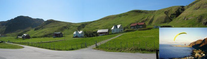
Møre og Romsdal - Herøy - Runde
(Data fra flightlog.org - statistikk siste flyture)

Be sure to check "Link to more info"

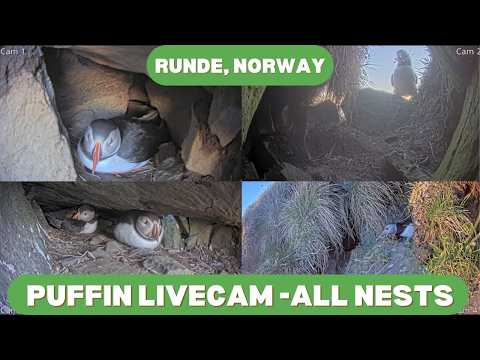
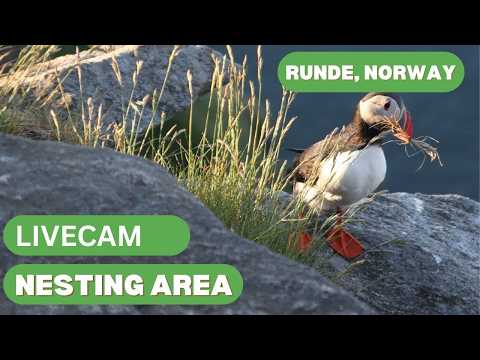
Important. Be assured to not violate the restrictions on the bird-nesting.
(Info here: http://faktaark.naturbase.no/DokumentData/Index/5119?title=Brosjyre&extension=.pdf)

It is NOT allowed to fly further north than the parking lot at the north-end of the road, or further sout than the tunell.

VIKTIG. Pass på å ikke krenke restriksjonene ang. hekkeperioden.
(Info her: http://faktaark.naturbase.no/Vern?id=VV00000690
Brosjyre: http://faktaark.naturbase.no/DokumentData/Index/5119?title=Brosjyre&extension=.pdf)

Det er IKKE tillatt å fly lengre nordover på hanget enn til P-plassen ved nordenden av veien, eller lengre sør enn til tunellen.

Flystedet ligger i Vigra TMA (2500ft-762m) Meld fra om flyging før start og etter landing til Vigra Tower tlf.: 67 03 21 75

Stratus Paragliderklubb - Sunnmøre

85 meters asl Høydeforskjell 82 meters

Kjenner du til denne spotten og har lyst å hjelpe Vindnå.no med oppdatert informasjon, sende inn dine endringsforslag her.

Bilde fra flightlog.org.

Kart

Værvarsel fra yr.no

 09:00  10:00  11:00  12:00  13:00  14:00  15:00  16:00  17:00  18:00  19:00  20:00  21:00  22:00  23:00  00:00  01:00  02:00  03:00 
yr.no
nedbør0.10.30.40.60.21.31.340.10000000000
m/s 2.93.83.88.16.56.36.15.74.313.413.811.811.913.214.21616.713.87.8
S
(194)
SV
(204)
S
(196)
SV
(230)
S
(200)
S
(198)
S
(198)
S
(198)
S
(179)
SV
(223)
SV
(231)
SV
(227)
SV
(217)
SV
(215)
SV
(217)
SV
(221)
SV
(229)
SV
(243)
V
(256)
C13.113.614.113.813.813.913.713.613.414.11413.913.713.413.513.413.112.913.1

Live værdata Fv 5876 Rundebrua 3.1 km unna.

 08:10  08:00  07:50  07:40  07:30  07:20  07:10  07:00  06:50  06:40  06:30  06:20  06:10  06:00  05:00  04:00  03:00  02:00  01:00  00:00  23:00 
m/s 3.94.34.31.40.71.61.82.63.43.32.23.23.321.70.91.31.31.54.64.7
max 4.85.564.11.72.42.73.344.44.14.34.42.72.41.62.32.12.46.36.6
S
(179)
S
(181)
S
(179)
S
(174)
S
(183)
Ø
(83)

(123)

(141)
S
(169)
S
(182)
S
(189)
S
(182)
S
(174)

(145)

(139)
SV
(224)
SV
(212)

(118)
V
(278)
S
(185)
S
(179)
C10.910.810.711.111.211.111.211.31111.110.910.91110.61111.211.711.911.911.611.1

Live værdata STRATUS Mulevika 7.0 km unna.

 08:10  08:00  07:50  07:40  07:30  07:20  07:10  07:00  06:50  06:40  06:30  06:20  06:10  06:00  05:00  04:00  03:00  02:00  01:00  00:00  23:00 
m/s 0.30.60.81.90.80.600.60.81.40.60.300.30.30.20.20.821.40.4
max 0.81.41.43.31.40.80.61.11.73.11.90.60.60.60.90.80.71.32.52.21.1
S
(177)
SV
(212)
S
(188)
S
(183)
SV
(205)
SV
(230)
S
(180)
V
(272)
S
(164)

(113)

(146)

(30)
NV
(315)
S
(183)
N
(359)
NV
(318)
NV
(327)
N
(359)
N
(18)
N
(5)
Ø
(87)
C12.212.312.112.111.811.911.812.112.212.311.811.611.611.711.711.611.912.112.312.412.5

Live værdata Fv 654 Herøybrua 11.1 km unna.

 08:10  08:00  07:50  07:40  07:30  07:20  07:10  07:00  06:50  06:40  06:30  06:20  06:10  06:00  05:00  04:00  03:00  02:00  01:00  00:00  23:00 
m/s 6.34.85.44.64.23.33.61.51.51.42.73.13.22.92.41.51.32.32.53.83.6
max 7.26.36.96.66.85.75.22.72.32.63.83.74.34.23.42.2233.75.34.7

(133)

(129)

(137)

(142)

(143)

(136)

(153)

(133)

(131)

(133)

(127)
Ø
(109)

(123)

(120)

(123)

(123)
Ø
(94)
Ø
(78)

(118)

(141)

(144)
C11.911.91211.911.91211.9121211.9121212.412.212.112.112.712.713.112.912.7

Live værdata STRATUS Roppehornet 12.2 km unna.

 08:10  08:00  07:50  07:40  07:30  07:20  07:10  07:00  06:50  06:40  06:30  06:10  06:00  05:00  04:00  03:00  02:00  01:00  00:00  23:00 
m/s 2.83.12.81.10.800.61.11.41.90.81.10.81.11.40.90.20.40.72.8
max 3.94.23.91.91.40.31.11.91.92.51.42.51.71.721.40.40.71.33.9
S
(163)

(156)
S
(162)
S
(183)

(156)
S
(179)
S
(186)
S
(196)
S
(169)
SV
(209)
S
(188)
SV
(219)
SV
(225)
SV
(212)
SV
(217)
SV
(221)
NV
(317)
V
(278)
SV
(228)
S
(192)
C11.211.21111.311.311.411.311.311.11110.510.610.310.610.911.411.211.211.311.4

Webkamera Sandsøya 18.4 km unna. (www.sandsoyveret.com)