logo Vind Nå Kom igang Kontakt info Innstillinger

Herøy, Runde - Sørhanget paragliding spot

SSV

Møre og Romsdal - Herøy - Runde
(Data fra flightlog.org - statistikk siste flyture)

Important. Be assured to not violate the restrictions on the bird-nesting.

Check "Link to more info" before flying!!!

(Info here: http://faktaark.naturbase.no/DokumentData/Index/5119?title=Brosjyre&extension=.pdf)


VIKTIG. Pass på å ikke krenke restriksjonene ang. hekkeperioden.
(Info her: http://faktaark.naturbase.no/Vern?id=VV00000690
Brosjyre: http://faktaark.naturbase.no/DokumentData/Index/5119?title=Brosjyre&extension=.pdf)

Flott hang mot sør sør øst, ca 20 min å gå opp til start
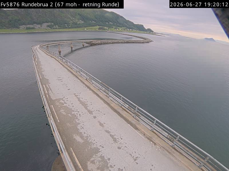
Kjør over runde brua og ta av til venstre kjør ut tilnesten enden av vegen, der går en merket sti opp

Flystedet ligger i Vigra TMA (2500ft-762m) Meld fra om flyging før start og etter landing til Vigra Tower tlf.: 67 03 21 75

Stratus Paragliderklubb - Sunnmøre

300 meters asl Høydeforskjell 300 meters

Kjenner du til denne spotten og har lyst å hjelpe Vindnå.no med oppdatert informasjon, sende inn dine endringsforslag her.

Kart

Værvarsel fra yr.no

 15:00  16:00  17:00  18:00  19:00  20:00  21:00  22:00  23:00  00:00  01:00  02:00  03:00  04:00  05:00  06:00  07:00  08:00  09:00  10:00 
yr.no
nedbør00000000000000000000
m/s 2.95.83.32.3332.10.81.12.62.42.41.92.13.644.24.23.93.3
S
(183)
SV
(224)
SV
(230)
SV
(227)
SV
(232)
SV
(220)
SV
(227)
SV
(227)
Ø
(88)
Ø
(79)
Ø
(82)
Ø
(78)
Ø
(85)
Ø
(71)

(65)

(66)

(64)

(62)

(58)

(55)
C14.61513.913.513.813.613.212.711.710.810.710.710.710.610.911.211.712.21313.9

Live værdata Fv 5876 Rundebrua 1.7 km unna.

 15:30  15:20  15:10  15:00  14:50  14:40  14:30  14:20  14:10  14:00  13:50  13:40  13:30  13:20  13:10  13:00  12:00  11:00  10:00  09:00  08:00  07:00  06:00 
m/s 6.77.47.57.46.14.93.14.45.14.24.73.92.51.61.71.93.72.64.65.46.16.25.1
max 9.59.48.697.56.94.76.46.97.76.26.54.62.93.53.95.54.88.29.19.28.87.9
SV
(244)
SV
(239)
SV
(243)
SV
(241)
SV
(243)
V
(249)
SV
(237)
SV
(241)
SV
(239)
SV
(237)
SV
(238)
SV
(241)
SV
(229)
S
(180)
S
(173)
S
(191)
SV
(217)
SV
(234)
S
(161)
S
(159)
S
(159)

(157)
S
(160)
C1613.714.216.816.914.113.713.715.213.913.813.71416.316.513.51416.215.215.414.613.512.7

Live værdata STRATUS Mulevika 6.7 km unna.

 15:30  15:20  15:10  15:00  14:50  14:40  14:30  14:20  14:10  14:00  13:50  13:40  13:30  13:10  13:00  12:00  11:00  10:00  09:00  08:00  07:00  06:00 
m/s 14.410.310.38.67.87.27.56.99.410.8108.99.711.16.94.44.14.53.14.14.84.7
max 16.412.813.111.1109.28.99.211.414.213.614.21513.99.46.35.86.84.96.37.57.5
SV
(245)
SV
(245)
SV
(243)
SV
(245)
SV
(245)
SV
(244)
SV
(246)
SV
(224)
SV
(245)
SV
(242)
SV
(242)
SV
(225)
SV
(225)
SV
(239)
SV
(226)
S
(202)
SV
(221)
SV
(205)
S
(184)
S
(183)
S
(195)
S
(177)
C11.212.512.612.812.812.812.512.412.312.312.412.212.512.412.311.711.912.512.512.211.911.4

Live værdata Fv 654 Herøybrua 9.6 km unna.

 15:30  15:20  15:10  15:00  14:50  14:40  14:30  14:20  14:10  14:00  13:50  13:40  13:30  13:20  13:10  13:00  12:00  11:00  10:00  09:00  08:00  07:00  06:00 
m/s 5.62.73.83.82.11.61.83.15.54.54.95.23.63.82.72.43.64.15.76.35.95.53.5
max 6.75.855.13.63.42.84.88.37.96.87.25.46.44.44.55.66.28.499.37.75.9
V
(263)
SV
(206)

(132)

(133)
S
(165)
SV
(227)
SV
(227)
SV
(230)
SV
(215)
S
(184)
S
(182)
S
(180)
S
(165)

(153)

(140)
S
(182)
S
(168)

(138)

(139)

(132)

(136)

(134)

(143)
C1414.714.814.7151514.714.21414.214.514.214.214.114.1141414.814.413.713.212.712.2

Live værdata STRATUS Roppehornet 11.4 km unna.

 15:30  15:20  15:10  15:00  14:50  14:40  14:30  14:20  14:10  14:00  13:50  13:40  13:30  13:20  13:10  13:00  12:00  11:00  10:00  09:00  08:00  07:00  06:00 
m/s 1.91.12.21.41.90.81.11.74.45.83.65.86.14.76.96.75.35.85.35.76.16.85.8
max 4.23.34.23.16.13.33.34.48.68.67.88.98.31011.112.28.48.68.198.910.99.3

(117)
SV
(244)

(153)
S
(174)
S
(170)

(40)

(23)
S
(163)
S
(176)
S
(162)
S
(181)
S
(158)

(140)

(154)

(157)
S
(161)
S
(172)
S
(178)

(156)
S
(166)
S
(168)
S
(161)
S
(163)
C12.712.712.713.112.712.811.911.511.911.911.911.911.611.611.511.612.113.112.611.911.71110.4

Live værdata Flø 12.1 km unna.

 15:30  15:20  15:10  15:00  14:50  14:40  14:30  14:20  14:10  14:00  13:50  13:40  13:30  13:20  13:10  13:00  12:00  11:00  10:00  09:00  08:00  07:00  06:00 
m/s 5.34.43.63.33.62.52.54.74.46.95.356.75.86.77.85.43.42.91.724.14.6
max 6.45.34.43.94.73.63.66.16.48.98.98.99.28.69.710.87.85.85.33.13.36.67.2
V
(271)
V
(252)
V
(266)
V
(271)
V
(255)
V
(254)
SV
(228)
SV
(220)
SV
(214)
SV
(209)
S
(200)

(148)

(142)

(149)
S
(158)

(152)
S
(185)

(149)
SV
(210)
S
(177)
SV
(227)
S
(181)
S
(167)
C14.214.214.715.115.616.214.514.615.514.314.614.514.31413.913.714.615.915.714.914.213.712.9

Live værdata Ulsteinvik 13.1 km unna.

 15:30  15:20  15:10  15:00  14:50  14:40  14:30  14:20  14:10  14:00  13:50  13:40  13:30  13:20  13:10  13:00  12:00  11:00  10:00  09:00  08:00  07:00  06:00 
m/s 0.520.61.41.80.90.81.30.42.943.82.33.33.42.51.71.62.91.41.512.8
max 13.60.62.62.12.11.63.12.14.65.15.14.63.35.14.63.334.83.53.22.44.5

(152)
S
(167)
S
(191)
S
(170)
S
(182)
SV
(220)
SV
(241)
S
(172)

(132)

(140)
S
(163)

(151)

(143)

(140)

(134)

(148)

(156)
S
(167)

(141)

(130)

(137)

(134)

(142)
C15.215.115.615.915.615.815.914.614.314.214.114.314.113.613.513.614.215.714.513.713.112.612.1

Webkamera Sandsøya 17.5 km unna. (www.sandsoyveret.com)